Map of Brooklyn - 1874
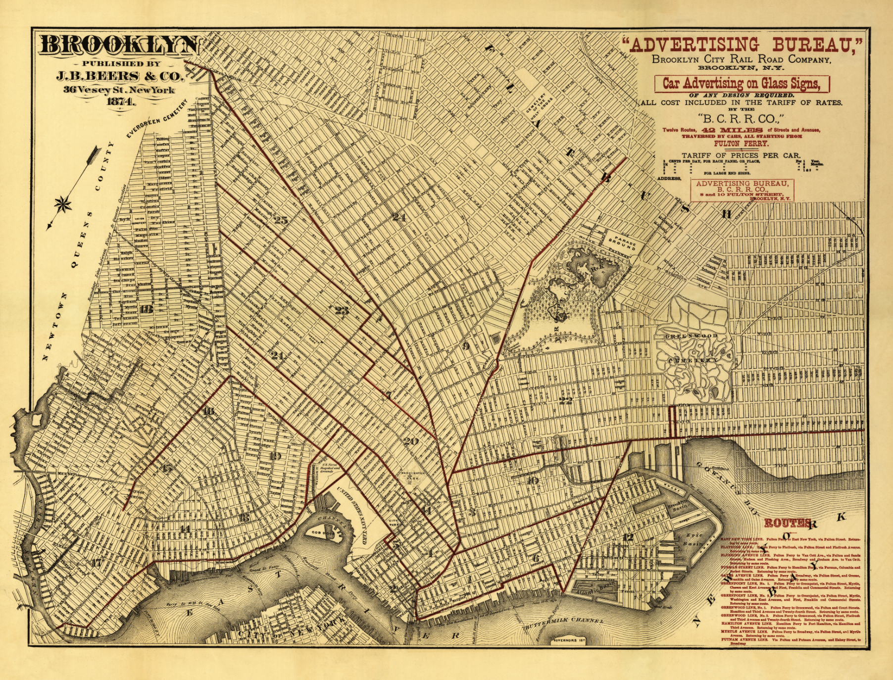


Map of Brooklyn - 1874
from $30.00
Archival Map Print of Brooklyn published for Advertising Bureau, Brooklyn City Rail Road Company. Overprinted in brown to show "Twelve Routes, 42 miles of Streets and Avenues Traversed by Cars, all Starting from Fulton Ferry." Contains a list of routes in lower left of map.
Print size: 31”x 23.63”
Final Frame Size 39.38" × 32.00"
Options:
Quantity:
For a digital download, a link to download the print-ready file will be sent to you within 24 hours of purchase. You will have 48 hours to download before the link expires.


