New York City Map- 1884


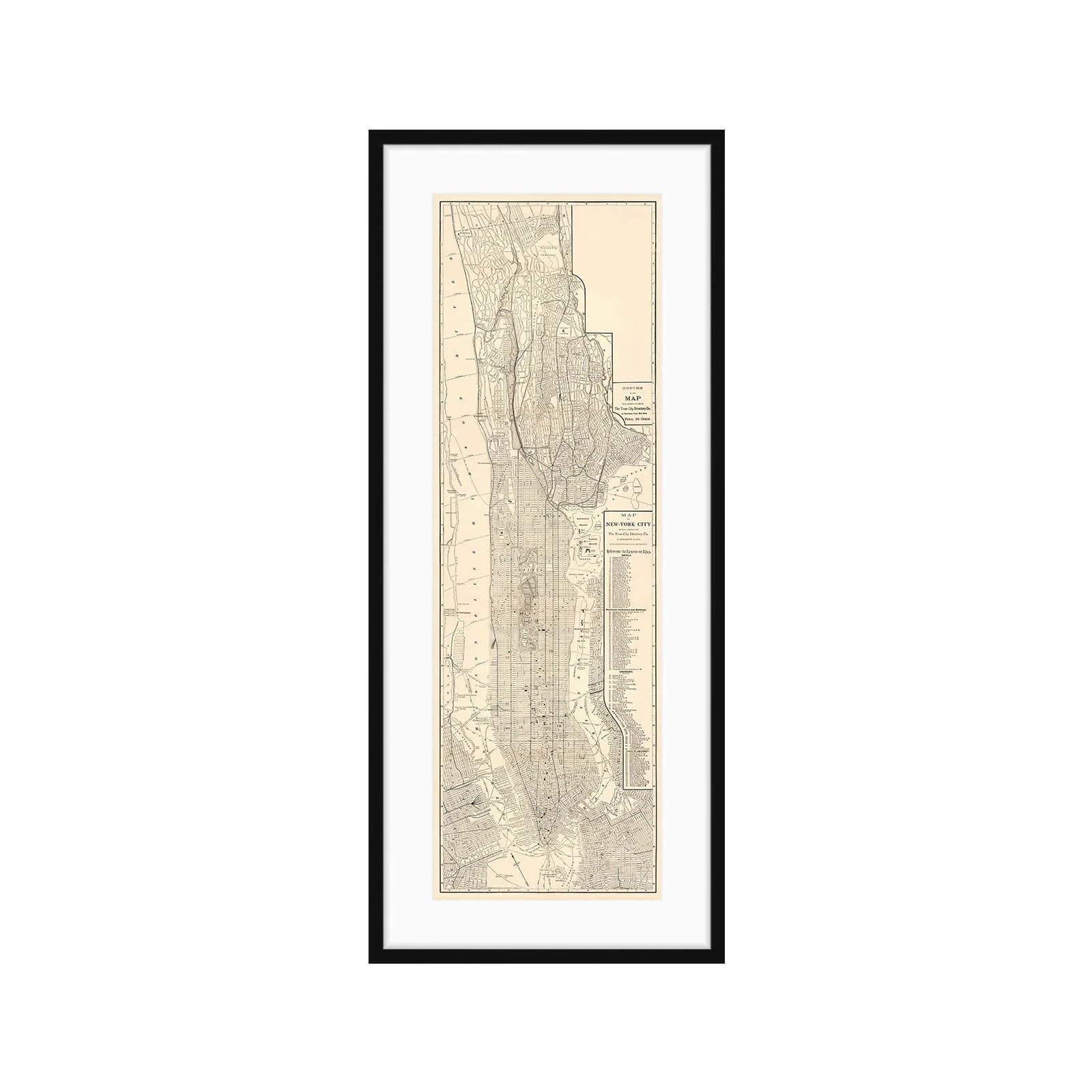
New York City Map- 1884
The original map of New York City was prepared expressly for The Trow City Directory Co. and was created by Matthews-Northrup Company, in Buffalo NY in 1884.
It features prominent Institutions, buildings, churches, and places of amusement with a grid and number system. There is also a radial distance from city hall guide and nearly all the streets are named. It was made to be folded up and carried in your pocket so the original had deep stains and creases on all of the folds. We carefully scanned it at the highest possible resolution and stitched it back together to restore it to its original size and shape. We print all of our reproductions on museum quality archival paper that is made to last centuries.
Large print on museum-quality archival water color paper.
Large Framed Print:
Map size: 11” x 34.2"
Final framed size: 18.25” x 42”
What you see is what you get. No tax or shipping cost will be added to the price you see above.
LOOKING FOR SOMETHING SPECIFIC?
We have a large selection of maps that are not yet available online. We also love to hunt for new (old) maps. If you are looking for something, in particular, please don't hesitate to reach out and we'll do our best to find it!


